|
Perfect for the historian, the student, or the lover of
American History! Digitally captured for your eternal
collection!
Don't know which disk to choose?
Want all the railroad map collections? The contents of this
CD and all our railroad map CD's, as well as an extra gigabyte of
other historical transportation maps is included on my Complete Railroad
collection DVD, now available in our store. Just view the "Railroad Map" category to view the entire
collection.
The Railroad maps represent an important historical
record, illustrating the growth of travel and settlement as well as the
development of industry and agriculture in the United States. They
depict the development of cartographic style and technique, highlighting
the achievement of early railroaders.
This CD contains historical Railroad lines from A - B,
including the following:
|
Contains a total of 41 Super High
Quality Images of historic Railroad Maps.
If you see the same
railroad line listed more than once, that means each map is
still different, either made in a different year, or made by a
different company covering the same line/region.
Some samples:
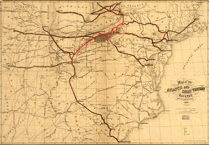
Map of the Atlantic and Great Western Railway, with its
connections, 1866.
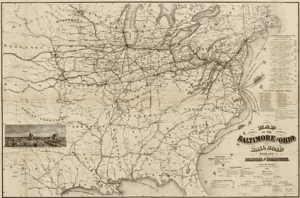
Map of the Baltimore and Ohio Rail Road with
its branches and connections.
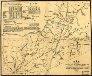
Map of the Boston & Woonsocket rail road
routes compiled from the state map, and the plans of the
different surveys returned to the joint standing committee on
railroads & canals.
 |
Complete List:
Adams Express Company
Allegheny Railroad and Coal Company
American Central Railway
Arkansas Central Railroad
Atchison, Topeka, and Santa Fe Railroad Company 1880
Atchison, Topeka, and Santa Fe Railroad Company 1883
Atchison, Topeka, and Santa Fe Railroad Company 1884
Atchison, Topeka, and Santa Fe Railroad Company 1886
Atchison, Topeka, and Santa Fe Railroad Company 1899
Atchison, Topeka, and Santa Fe Railway Company
Atlanta and LaGrange Rail Road Company.zip
Atlanta and West Point Rail Road Company.zip
Atlantic and Great Western Railway Company
Atlantic and Pacific Railroad Company 1873
Atlantic and Pacific Railroad Company 1883
Atlantic and Pacific Railroad Company 1883
Atlantic, Mississippi & Ohio Railroad Company
Baltimore and Ohio Railroad Company 1831
Baltimore and Ohio Railroad Company 1840
Baltimore and Ohio Railroad Company 1840s
Baltimore and Ohio Railroad Company 1843
Baltimore and Ohio Railroad Company 1850
Baltimore and Ohio Railroad Company 1857
Baltimore and Ohio Railroad Company 1860
Baltimore and Ohio Railroad Company 1876
Baltimore and Ohio Railroad Company 1878
Baltimore and Ohio Railroad Company 1890
Baltimore and Susquehanna Railroad Company
Bellaire, Zanesville & Cincinnati Railway
Bellefontaine and Indiana Railroad Company
Black Diamond System
Boston & Woonsocket Railroad
Boston and Lowell Railroad Corporation
Boston and Maine Railroad
Boston and Providence Railroad Corporation
Boston, Concord, and Montreal Railroad
Boston, Hoosac Tunnel, and Western Railway
Brooklyn City Railroad
Burlington and Missouri River Railroad Company 1876
Burlington and Missouri River Railroad Company 1882
Burlington, Cedar Rapids, and Minnesota Railroad Company
 |
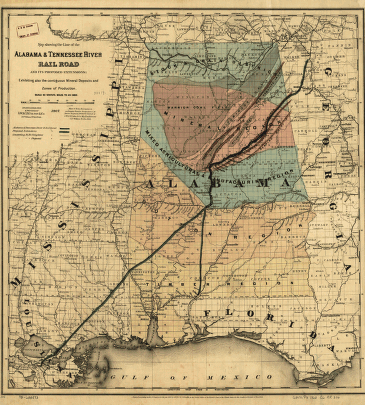
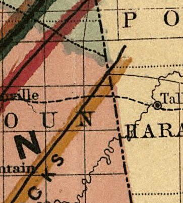
QUALITY SAMPLE - ZOOM VIEWS:
All of these maps are shown in extreme high quality, high
level of detail. These are top quality scans, not some of the
lower cheapo quality scans some other folks are selling! Most of
these maps were 36" or 48" wide, and they are scanned in at the highest
setting at full size. You can take these images to your local
print shop, and get full size color prints that are 36" or more wide to
hang on your wall, and the quality is there to make it look like the
original map. That is why you may not get a huge number of maps on
one CD, because the file sizes are fairly large. Most of these
image files are 5-10 Megs in size, EACH, and that is in a compressed
format! Here is a sample close up to give you an idea of the kind
of grade A material we are talking about here:
 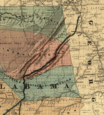
Zoom in some more:
 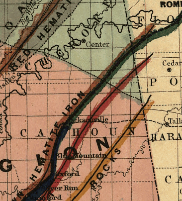
And finally, at the highest zoom setting (full size,
normal view), here is what it looks like:
Custom viewer software to is required to view these
files, but that is all included on this disk for you! You will not
need to purchase any additional software to view these files in the
detail as they are designed to be at. This disk is supported by
Windows. |